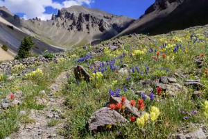
- The Bridger Mountains lie north of Bozeman and are accessible year round.
- Activities in the Bridger Mountain Range include skiing and hiking.
- The mountains are the home to the ski area, Bridger Bowl.
Overview
The Bridger Mountains are in a remarkable location offering a great escape into the great outdoors just minutes from the town of Bozeman. A truly magical time of year is in the fall when the golden eagles are passing through on their southerly migration.
Location/Directions
The Bridger Mountain Range lies to the north of Bozeman. It is home to the Bridger Mountains National Recreation Trails and Bridger Bowl Ski Area. Many recreational opportunities can be found in this scenic mountain range because of its close proximity to Bozeman, yet this area retains it remote look and feel.
Seasons
The Bridger Mountains Montana are accessible year round. They are a wonderful playground for both summer and winter activities.
Activities
The primary activities enjoyed in the Bridger Mountains is skiing in the winter and hiking in the summer.
Skiing
Home to the ski area of Bridger Bowl, the Bridger Mountains has been the locals favorite mountains since the first rope tow was installed in 1951. On average, the ski area receives 350 inches of snow every year.
Backcountry skiing is also very popular with snow being available on peaks such as Sacagawea from early November until late May/early June.
Hiking
The glorious spring and summer in the Bridger Mountain Range produces alpine wildflowers, abundant wildlife, and stunning rock outcrops to behold. There are several well-known hikes in the area. The following is just a sampling of these –
Fairy Lake Trail
Fairy Lake is a picture-perfect, tree-lined lake sitting in a forested bowl at the base of Sacagawea Mountain. The lake receives heavy use due to its close proximity to the Fairy Lake Campground, located a short quarter mile from the lake. The trail loops around the perimeter of the lake for a total distance 1.2 miles. It is classified as an easy to moderate trail. This high mountain area is a great place to have a picnic and spend the day.
Sacagawea Peak
Sacagawea Peak, at 9,665 feet, is the highest peak in the Bridger Range, part of the Gallatin National Forest. The trail climbs up Sacagawea Mountain to a saddle between Sacagawea Peak and Hardscrabble Peak at the Bridger Divide. The trail is an easy to moderate, 4 miles, out and back.
Truman Gulch Trail
The Truman Gulch Trail parallels the Truman Gulch drainage up canyon to the Bridger National Recreation Trail. The trail is surrounded by forested rolling mountains and beautiful views. The hike stays close to the trickling sound of the stream and has several stream crossings. This is an easy to moderate out and back trail which is a total of 4 miles.
Additional Info
A defining human element of the range is clearly visible from the town of Bozeman. At the ranges south end, facing the city of Bozeman is a large "M" constructed out of rocks, which have been painted white. It is representative of Montana State University and is located on the side of Baldy Mountain.
The parking area to the "M" trail is also a picnic area. It is located about 3 miles North of Bozeman on Hwy 86 on the left. Look for a large brown sign on the right indicating the turnoff.


